Holmehill Community Buyout |

|
1950 |
|
| Home ► The Hill ► From the Air ► 1950 | |
| 1928 • 1950 • 1958 | |
|
|
|
|
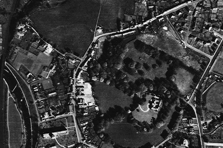
A photograph from 1950, with north at the top. At the left-hand edge is the dark curve of the railway, with the Allan Water emerging from under the railway half-way down that edge. Beside the river, the Cathedral is visible at the bottom edge of the picture, with Braeport and Ramoyle going northwards then north-east towards Perth Road. Holmehill is the wooded area in the right-hand half of the picture: the old mansion is clearly shown in its circle of trees. (The area in the photograph is also covered in the maps at Street View and 1866 Map, which may be helpful in interpreting the features in the photograph.) |
| ◀ 2 of 3 ► |
|
|
|
| © Holmehill Community Buyout | Page built by ASCCLinX |
| Content: 8th September 2016 | |